Tuesday, October 23, 2012

Komodo Dragons at Komodo National Park

The Komodo Dragon (Varanus Komodoensis) is the largest species of lizard found in Indonesia Islands of Komodo, Rinca, Flores, Gili Motang, and Padar. It is growing to maximum length of 3 metres (10ft) in rare cases and weighng up to around 70 kilograms (150 lb). Unusual size of the lizards has been attributed to island gigantism, since there are no other carnivorous animals to fill the niche on the islands where they live. Komodo Dragons exist nowhere else in the world and become great interest to scientists studying the theory of evolution.
The Komodo Dragon
Komodo Dragons Having Sex

Komodo National Park is located in the center of the Indonesian archipelago, between the islands of Sumbawa and Flores, East Nusa Tenggara Province. This area established as National Park since 1980. The main purpose of this National Park is to conserve the unique Komodo Dragon and also protecting entire biodiversity, both terrestrial and marine. They are protected under Indonesian law. In 1986, Komodo National Park was declared a World Heritage Site and a Man and Biosphere Reserve by UNESCO.

Underwater Beauty at Komodo National Park

For experienced divers, Komodo National Park is very a great adventure. Komodo has the good reputation for being a diving area. There are many dive sites with strong and sometimes unpredictable currents with water temperatures change very often. In spite of these, Komodo has fantastic underwater experiences for divers. Big pelagics (Manta rays, sharks) are very common to see. Bio diversity of Komodo National Park is very outstanding both terrestrial and marine.

Manta Ray at Komodo National Park

Exotic Underwater at Komodo National Park

Labuan Bajo is a fishing town located at the western end of Flores in Nusa Tenggara province. It is the launching point for trips to Komodo Island and Rinca Island, home of the famous Komodo Dragon.

Some Popular Hotels in Labuan Bajo:

Sunday, October 21, 2012

Dieng Plateau, Abode of the Gods

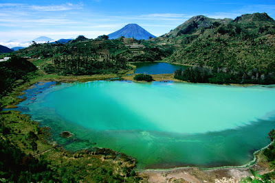
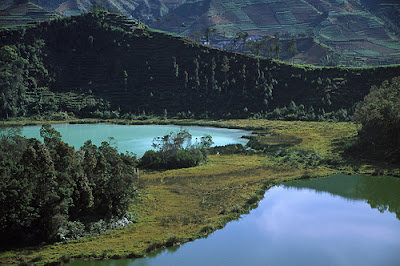
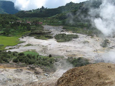
Dieng Plateau sitting up in the mountains about 150 kilometers northwest of Yogyakarta, around 150 kilometers southwest of Semarang, and 26 kilometers north of Wonosobo. With 2,093 above sea level, average temperature ranging from 10 degrees Celcius to 15 degrees Celcius. The name of Dieng which is literally derived from sansekerta word: "Di" means highland or mountain and "Hyang" means Heaven. Therefore, Dieng can be interpreted as a mountain range where god and goddess resides, or "Abode of the Gods". Dieng Plateau is a misty location that consists of small ancient temples set in the remarkable volcanic landscape, colored lakes, "mirror" lake, craters, sulphurous springs, and geothermal activities.

Colored Lake at Dieng Plateau
Old Hindu's Temples at Dieng Plateau

If you want to transport back to ancient times, Dieng Plateau is the right place. The temples in Dieng Plateau are the oldest Hindu's temples in Indonesia. The temples are remnants from the glorious period of the Hindu empire in Java dating back to the 7th and 8th centuries. From the bubbling mud holes, brightly colored sulphur lakes and thick mist surrounding the plateau, visitors will easily understand why the ancient Javanese considered this place to be the seat of supernatural powers.

The Beauty of Colored Lake at Dieng Plateau

Each of the temple is named with epic tale figures of the Mahabarata such as Bima, Gatotkaca, Arjuna, and Srikandi. It is believed that these temples used to serve as residences of Hindu priests who would spread Hindu teachings.
Beautiful Sky at Dieng Plateau

Dieng Plateau is the largest vegetable producer in Central Java. Potatoes are the main commodity as well as carrots, cabbage, tobacco, mushroom, purwaceng and also carica or mountain papaya.

Beautiful Panorama at Dieng Plateau
Unique Sky at Dieng Plateau
Sikidang Crater at Dieng Plateau

Some tips and information about hotels near to Dieng Plateau:
Kresna Gallery Hotel Wonosobo
Surya Asia Hotel Wonosobo
Pondok Bamboo Sendangsari Wonosobo

Monday, October 15, 2012

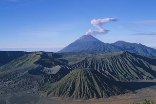
Mount Bromo, Beautiful Sunrise in Volcano

Found some 4 hours drive via Surabaya, the capital of East Java Province, Mount Bromo is part of Bromo Tengger Semeru National Park which covers a massive section of 800 square kilometres. The name of Bromo derived from Javanese pronunciation of Brahma, the Hindu creator god. At 2392 meters above the sea level, Mount Bromo is smaller when compared to some volcanoes within Indonesia, but this spectacular Mount  Bromo will not likely dissatisfy with its magnificent vistas and also remarkable panoramas.

Panorama at Bromo
Fire from The Earth at Bromo
Crater at Bromo

From a vantage point in Mount Penanjakan (2, 770 meters above sea level), 2.5 hours from Malang,  tourists from all over the world come to see the sunrise over Mount Bromo. From this position the vista is spectacular. Mount Bromo is in the middle of a vast plain called "Sea of Sand". The best views from Mount Bromo to the Sea of Sand below and surrounding volcanoes are at sunrise. Depending on the degree of volcanic activity. the Indonesian Centre for Vulcanology and Disaster Hazard Mitigation sometimes issues warnings against visiting Mount Bromo.

Beautiful Sky at Bromo
Horse at Bromo

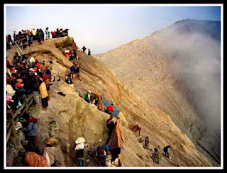
The particular eerie surroundings possesses spurned plenty of stories and also myths. Mount Bromo possesses unique value for Tengger people who believe this was a site where a fearless prince sacrificed their life for his family. The people right here appease this Gods yearly at the annual Kasada festival where offerings of vegetables, chickens, and money are thrown into the crater of the volcano.


Bromo after Sands Rain

Look Semeru Top from Bromo

Some hotels near to Mount Bromo:
Popular hotels in Surabaya
Popular hotels in Probolinggo
Popular hotels in Malang
Popular hotels in Pasuruan

Monday, October 8, 2012

Bintan Island, Beautiful Island near to Singapore and Malaysia

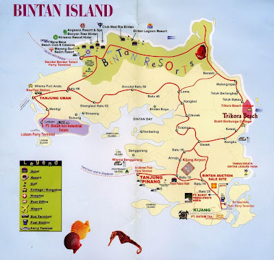
Bintan is the largest island in the Riau Islands, which consists of nearly 3,000 large and small islands, lies on the other side of Singapore and Johor Baru, Malaysia. The island is wide of Malacca to the South China Sea. Tanjung Pinang is the capital of the province, located on the south west coast of Bintan. Conveniently located in Malaysia's southern peninsula at the mouth of the Straits of Malacca, the Riau archipelago, before the first century AD, is a favorite place for Indian and Chinese merchant ships.


Bintan Island Map

Top tourist destinations here is the Bintan Resort, tourist destinations such as the spectacular beaches in the north of the island, with an area of ​​23,000 acres on the white sands overlooking the South China Sea. The island also has an interesting history in Tanjung Pinang and Biting, which offers opportunities for surfing, adventure and eco-tourism for students and families, but also ideal for relaxing and health.

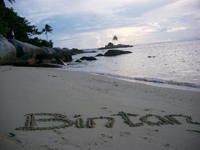
Beautiful Beach at Bintan

Meanwhile, for those who love diving Anambas Islands in South China Sea offers unspoiled dive sites, accessible from the airport Tanjung Pinang. Meanwhile, Natuna Islands can be reached from Batam.

Port at Bintan

No wonder again, in the 18th century, traders from Europe, Portuguese, Dutch and British fought for each island. At that time, the island is part of the Malay Peninsula, controlled by the Sultanate of Johor-Riau, which occupied alternated between Johor - Malaysia is at the moment - and the island of Bintan, Indonesia is today.

Wonderful Beach at Bintan

In 1884 Britain and the Netherlands shut down their opposition on the island by signing the Treaty of London, which then all area north of Singapore teritoris given in English, while the area south of Singapore teritoris submitted to the Netherlands.

Sunset at Bintan

Since then the fate and history of the north and south of Singapore separated. Singapore became the center of the development of British commerce, while the Dutch concentrated in Jakarta and Java, leaving islands of Bintan.

Beach with White Sands at Bintan

In recent decades, the friendly relations between Indonesia and Singapore, an agreement was signed between the two sides to build Bintan island together that will benefit both countries in the Free Trade Zone of Batam, Bintan and Batam island.

Coconut Trees at Bintan

The first form of this agreement is the development of Bintan Resorts, beach tourism destinations, covering an area of ​​23.000 acres on the beautiful white sands of Bintan overlooking the South China Sea.

Some informations about Bintan Island:
Top trending hotels in Bintan Island
Hotels near Trikora Beach
Hotels near Penyangat Island